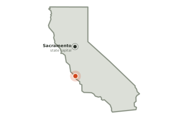
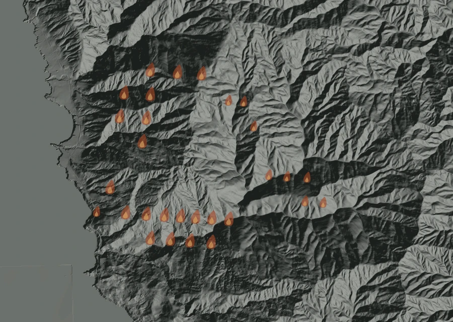
No cluster large enough to call a separate front. The heat is in one piece.
How it got here
21 days of record on a day-51 fire
The record here begins at 9:56am on 26 Aug and runs to 3:21am on 27 Sep — 761 hours, 2,609 readings of heat. The fire is on day 51, so the first 30 days are missing: nothing showed up from above until the fire was large enough and the sky over it clear enough for it to be seen.
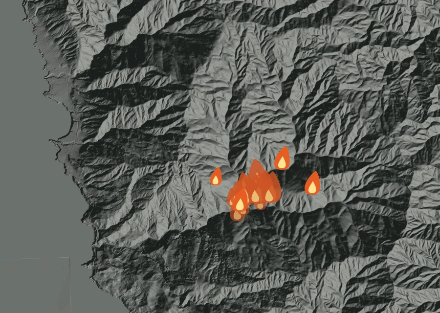
Day by day 21 days of record
-
Wed26 Aug
First readings
- 24 heat readings
- Heat from 9:56am to 8:57pm
- Spread 1.0 miles from the recorded point at its furthest
- Burning through the morning, afternoon and evening
-
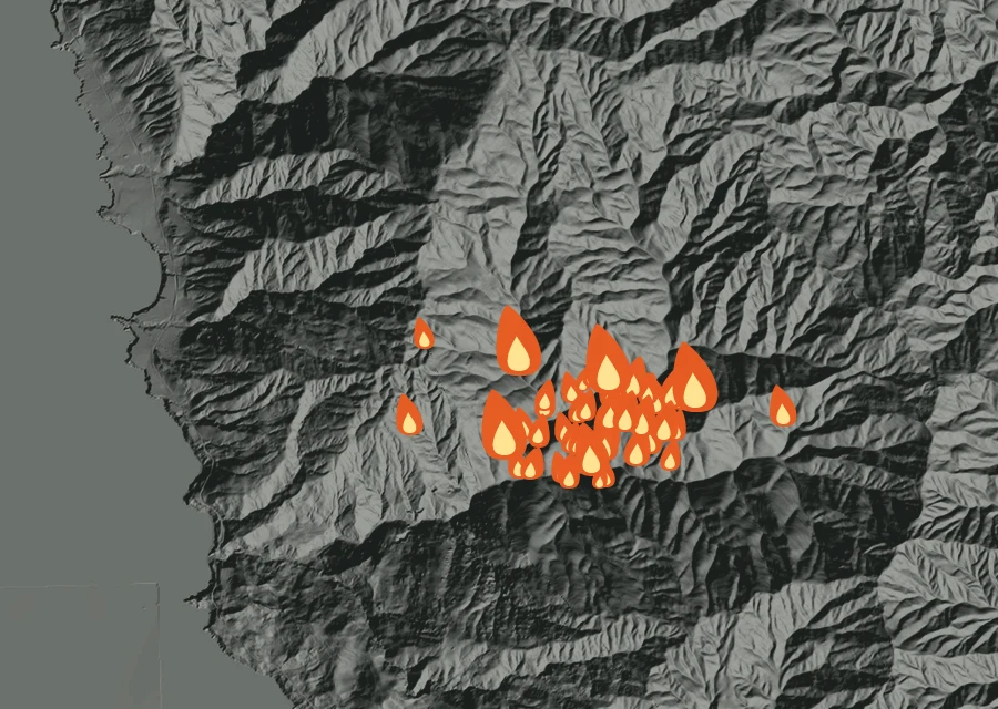
Thu27 Aug
Holding
- 47 heat readings
- Energy 1.0 times the day before
- Heat from 2:26am to 5:19am
- Spread 1.6 miles from the recorded point at its furthest
- Burning through the pre-dawn and morning
-
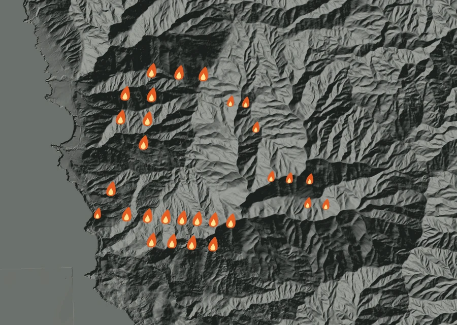
Fri28 Aug
Cooling off
- 38 heat readings
- Energy 75% down on the day before
- Heat from 2:07am to 2:23pm
- Spread 2.9 miles from the recorded point at its furthest
- Burning through the pre-dawn and afternoon
-
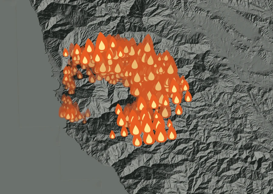
Sat29 Aug
The fiercest day
- 644 heat readings
- Energy 126.8 times the day before
- Heat from 2:24am to 9:17pm
- Spread 4.1 miles from the recorded point at its furthest
- Burning through the pre-dawn, morning, afternoon and night
-
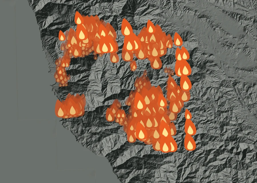
Sun30 Aug
Holding
- 838 heat readings — the most of any day
- Energy 21% down on the day before
- Heat from 2:07am to 9:55pm
- Spread 5.6 miles from the recorded point at its furthest
- Burning through the pre-dawn, morning, afternoon and night
-
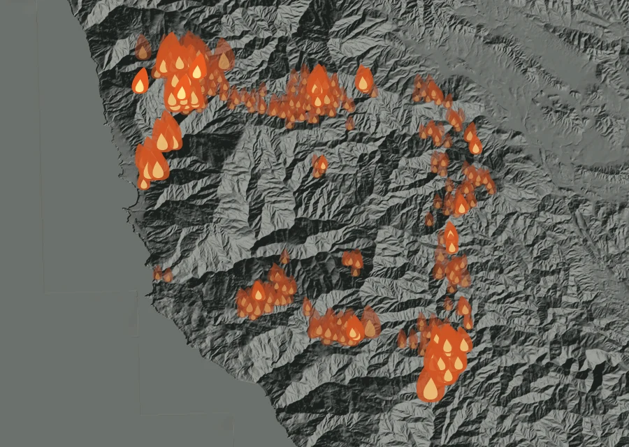
Mon31 Aug
Cooling off
- 463 heat readings
- Energy 89% down on the day before
- Heat from 2:05am to 8:57pm
- Spread 5.7 miles from the recorded point at its furthest
- Burning through the pre-dawn, morning, afternoon and evening
-
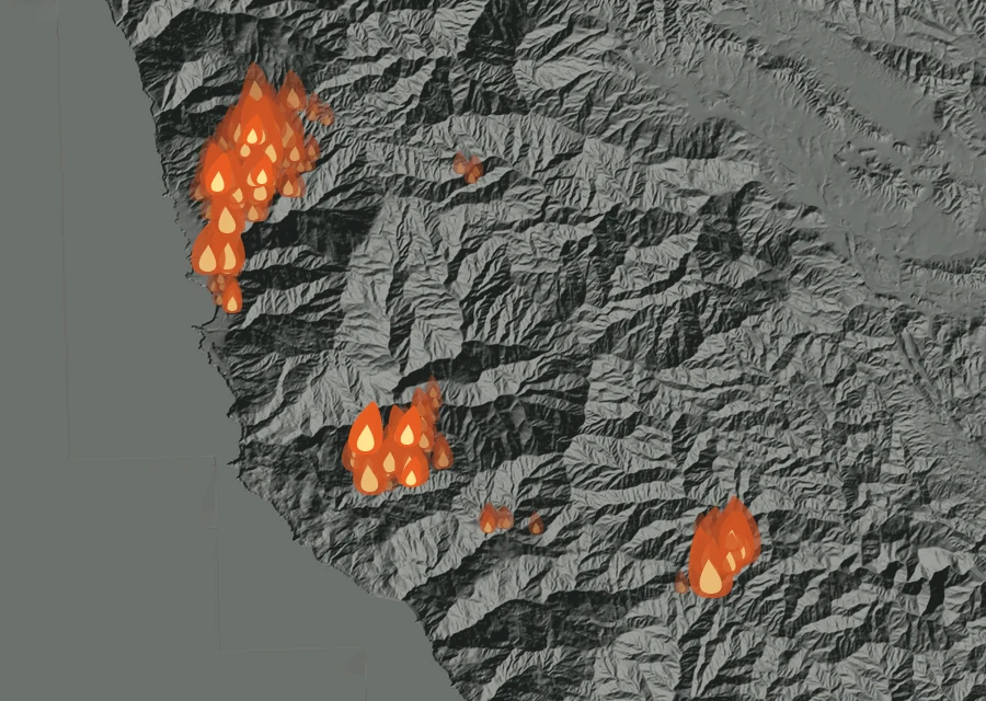
Tue1 Sep
Holding
- 275 heat readings
- Energy 25% down on the day before
- Heat from 2:32am to 9:34pm
- Spread 5.7 miles from the recorded point at its furthest
- Burning through the pre-dawn, morning, afternoon and night
-
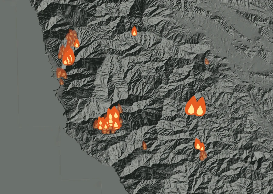
Wed2 Sep
Cooling off
- 118 heat readings
- Energy 65% down on the day before
- Heat from 2:13am to 4:50pm
- Spread 5.7 miles from the recorded point at its furthest
- Burning through the pre-dawn and afternoon
-
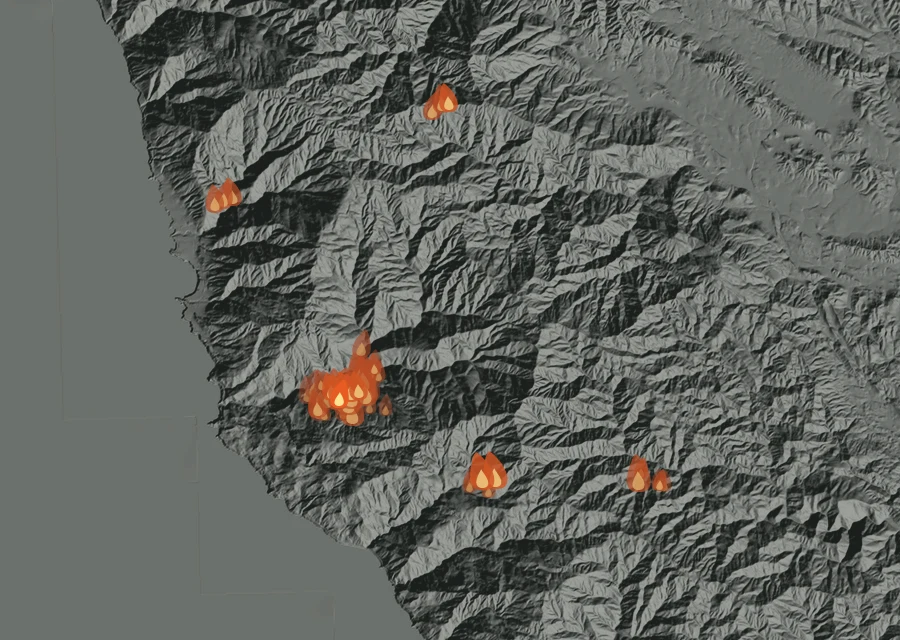
Thu3 Sep
Holding
- 67 heat readings
- Energy 48% down on the day before
- Heat from 1:54am to 9:14pm
- Spread 5.4 miles from the recorded point at its furthest
- Burning through the pre-dawn, morning, afternoon and night
-
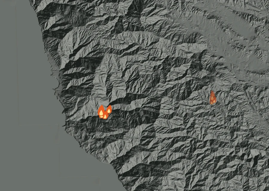
Fri4 Sep
Cooling off
- 11 heat readings
- Energy 91% down on the day before
- Heat from 2:11am to 3:12pm
- Spread 5.8 miles from the recorded point at its furthest
- Burning through the pre-dawn and afternoon
-
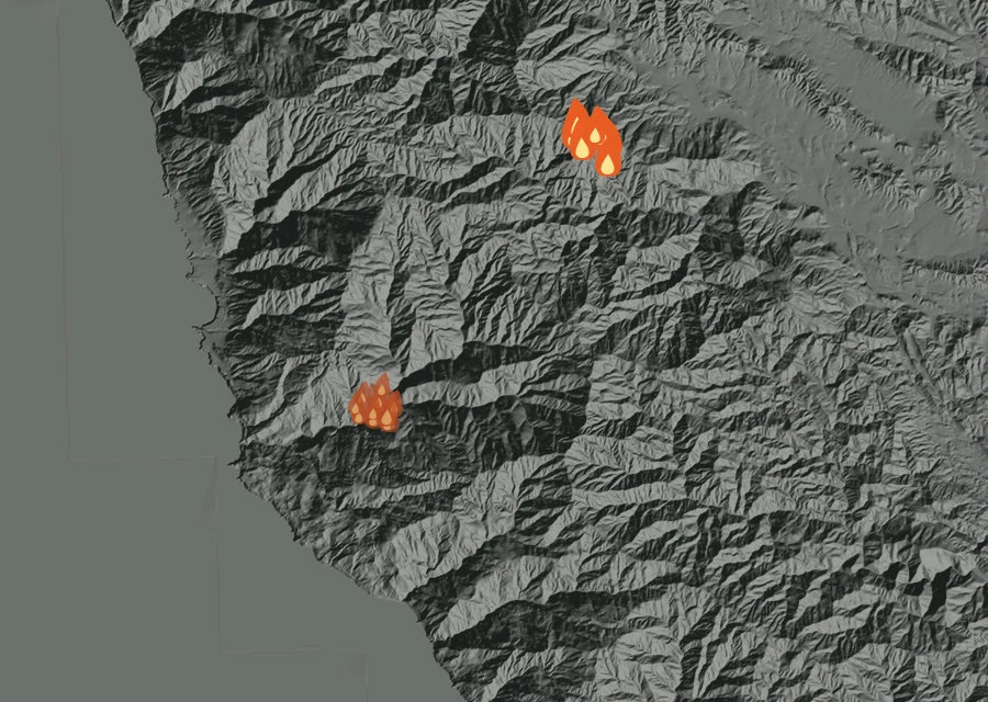
Sat5 Sep
Flaring up
- 24 heat readings
- Energy 4.5 times the day before
- Heat from 2:58am to 3:14pm
- Spread 4.8 miles from the recorded point at its furthest
- Burning through the pre-dawn and afternoon
-
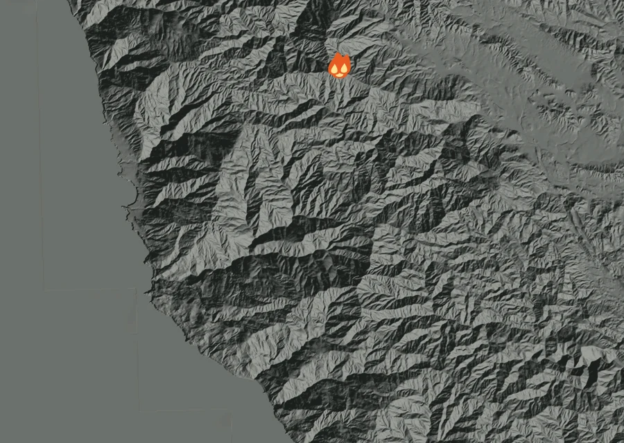
Sun6 Sep
Cooling off
- 3 heat readings
- Energy 83% down on the day before
- Heat from 2:33pm to 2:53pm
- Spread 4.8 miles from the recorded point at its furthest
- Burning through the afternoon
-
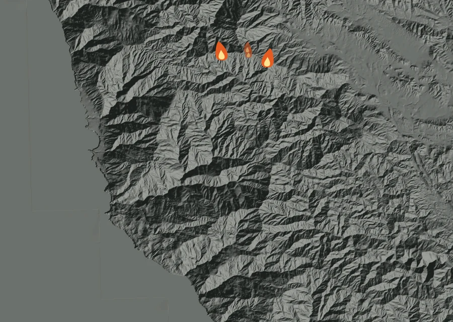
Mon7 Sep
Holding
- 4 heat readings
- Energy 1.1 times the day before
- Heat from 2:56am to 2:36pm
- Spread 4.7 miles from the recorded point at its furthest
- Burning through the pre-dawn and afternoon
-
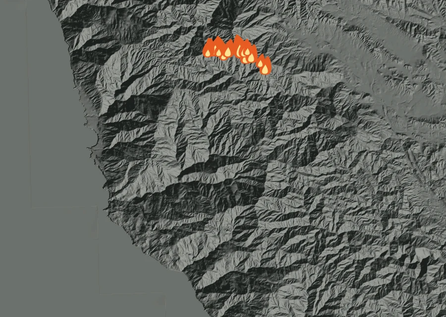
Tue8 Sep
Flaring up
- 19 heat readings
- Energy 8.2 times the day before
- Heat from 1:21pm to 3:01pm
- Spread 4.7 miles from the recorded point at its furthest
- Burning through the afternoon
-
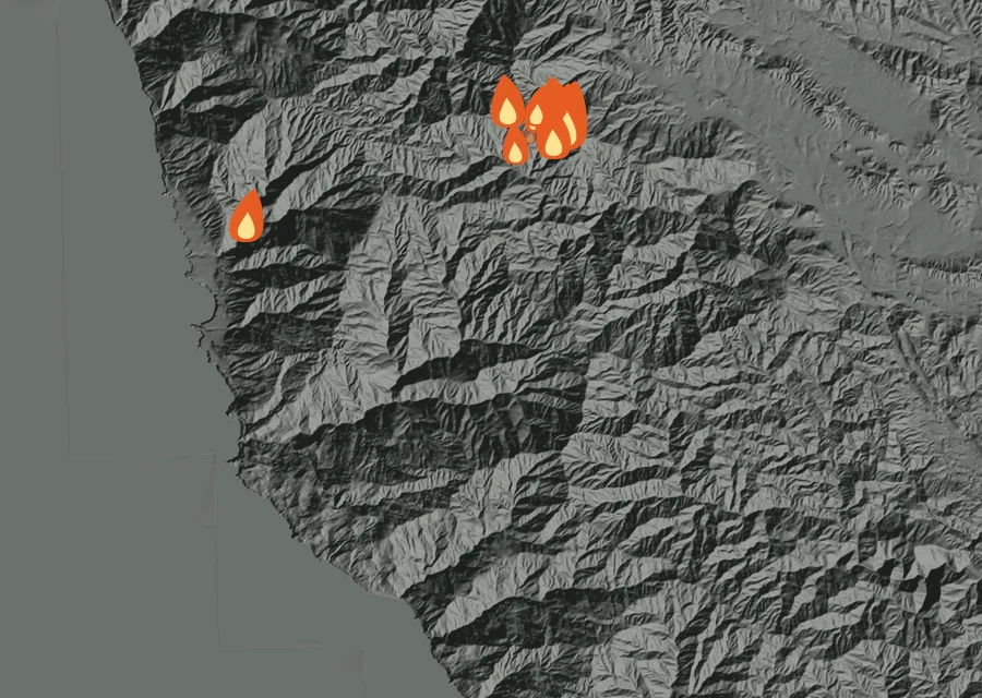
Wed9 Sep
Holding
- 12 heat readings
- Energy 1.2 times the day before
- Heat from 2:17am to 4:22pm
- Spread 4.8 miles from the recorded point at its furthest
- Burning through the pre-dawn and afternoon
-
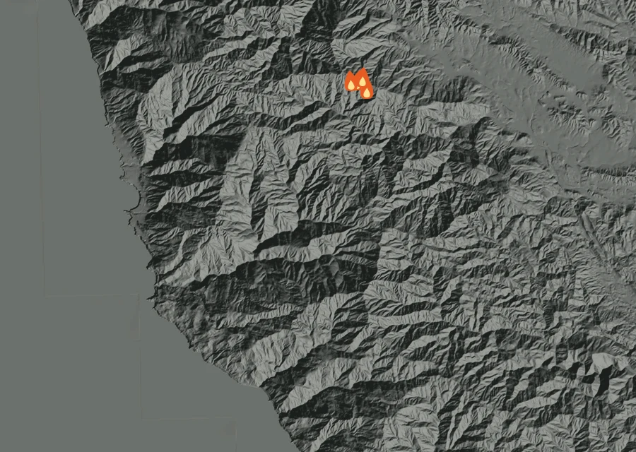
Thu10 Sep
Cooling off
- 4 heat readings
- Energy 93% down on the day before
- Heat from 1:19pm to 2:59pm
- Spread 4.6 miles from the recorded point at its furthest
- Burning through the afternoon
-
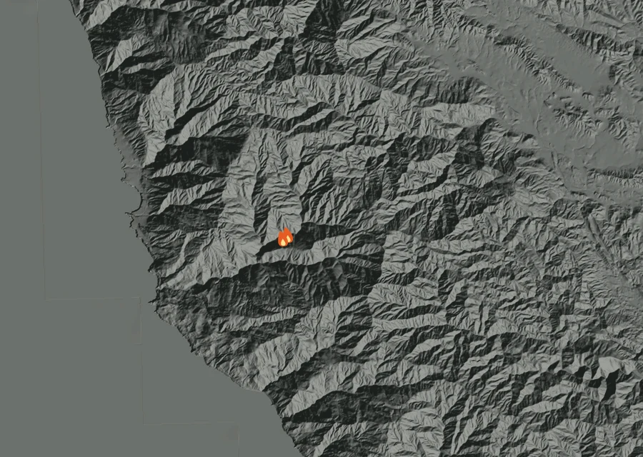
Sun13 Sep
Cooling off
- 2 heat readings
- Energy 96% down on the day before
- Heat from 2:43am to 3:04am
- Spread 0.5 miles from the recorded point at its furthest
- Burning through the pre-dawn
-
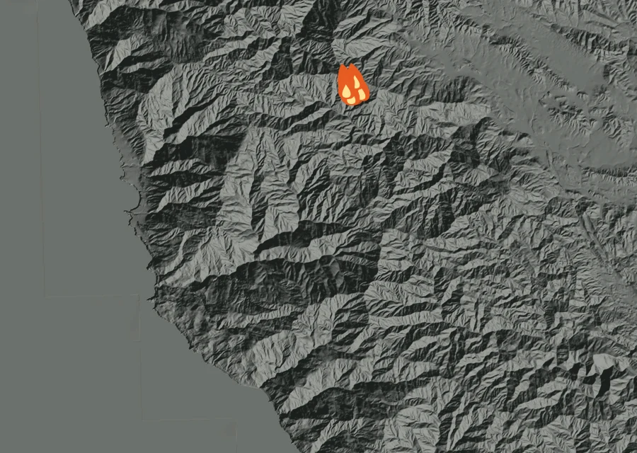
Mon14 Sep
Flaring up
- 10 heat readings
- Energy 151.0 times the day before
- Heat from 1:08pm to 4:14pm
- Spread 4.5 miles from the recorded point at its furthest
- Burning through the afternoon
-
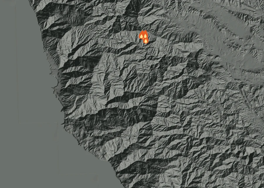
Tue15 Sep
Cooling off
- 4 heat readings
- Energy 80% down on the day before
- Heat from 1:25pm to 2:29pm
- Spread 4.4 miles from the recorded point at its furthest
- Burning through the afternoon
-
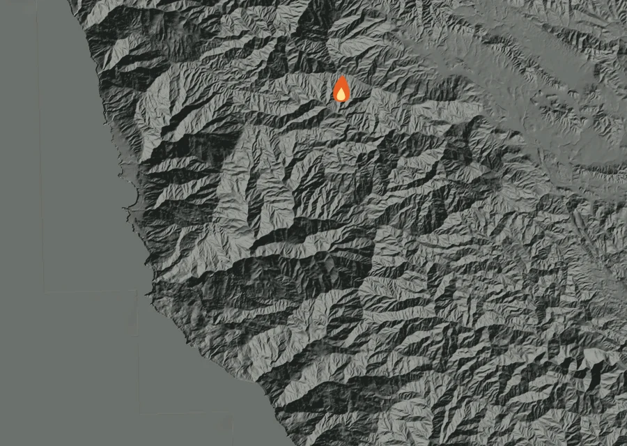
Sat19 Sep
Holding
- 1 heat readings
- Energy 10% down on the day before
- Heat from 2:55pm to 2:55pm
- Spread 4.1 miles from the recorded point at its furthest
- Burning through the afternoon
-
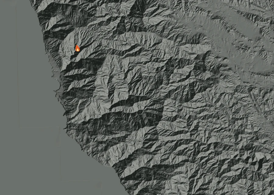
Sun27 Seplatest
Cooling off
- 1 heat readings
- Energy 93% down on the day before
- Heat from 3:21am to 3:21am
- Spread 3.9 miles from the recorded point at its furthest
- Burning through the pre-dawn
How the record has moved
Each step is a change on the interagency incident record — acreage, containment or crews — with the date it was reported. No satellite reading is involved.
-
Wednesday 26 August
First reported
-
Wednesday 26 August
0 acres on record
0 ac -
Wednesday 26 August
Grew to 100 acres
100 ac -
Thursday 27 August
Grew to 120 acres — containment 0%, 55 personnel
120 ac · 0% held · 55 crew -
Friday 28 August
Grew to 5,417 acres — 481 personnel
5,417 ac · 0% held · 481 crew -
Saturday 29 August
Grew to 8,241 acres — 661 personnel
8,241 ac · 0% held · 661 crew -
Saturday 29 August
Containment 1%
8,241 ac · 1% held · 661 crew -
Sunday 30 August
Grew to 15,479 acres — 897 personnel
15,479 ac · 1% held · 897 crew -
Monday 31 August
Grew to 26,734 acres — 955 personnel
26,734 ac · 1% held · 955 crew -
Tuesday 1 September
Grew to 28,968 acres — 1408 personnel
28,968 ac · 1% held · 1408 crew -
Wednesday 2 September
Grew to 29,123 acres — 1668 personnel
29,123 ac · 1% held · 1668 crew -
Thursday 3 September
Grew to 29,702 acres — containment 19%, 2058 personnel
29,702 ac · 19% held · 2058 crew -
Friday 4 September
Grew to 29,768 acres — containment 23%, 2134 personnel
29,768 ac · 23% held · 2134 crew -
Saturday 5 September
Grew to 29,831 acres — containment 31%, 2287 personnel
29,831 ac · 31% held · 2287 crew -
Sunday 6 September
Grew to 29,862 acres — containment 37%, 2211 personnel
29,862 ac · 37% held · 2211 crew -
Monday 7 September
Containment 47% — 2177 personnel
29,862 ac · 47% held · 2177 crew -
Tuesday 8 September
Containment 61% — 1879 personnel
29,862 ac · 61% held · 1879 crew -
Wednesday 9 September
Grew to 29,914 acres — containment 73%, 1447 personnel
29,914 ac · 73% held · 1447 crew -
Thursday 10 September
Grew to 29,942 acres — containment 79%, 1328 personnel
29,942 ac · 79% held · 1328 crew -
Friday 11 September
Containment 83% — 1285 personnel
29,942 ac · 83% held · 1285 crew -
Saturday 12 September
Grew to 29,961 acres — 729 personnel
29,961 ac · 83% held · 729 crew -
Sunday 13 September
Containment 89% — 456 personnel
29,961 ac · 89% held · 456 crew -
Monday 14 September
Grew to 29,976 acres — 468 personnel
29,976 ac · 89% held · 468 crew -
Tuesday 15 September
Grew to 29,993 acres — 348 personnel
29,993 ac · 89% held · 348 crew -
Wednesday 16 September
Containment 97% — 333 personnel
29,993 ac · 97% held · 333 crew -
Friday 25 September
Containment 98% — 431 personnel
29,993 ac · 98% held · 431 crew -
Sunday 27 September
Containment 99% — 372 personnel
29,993 ac · 99% held · 372 crew -
Tuesday 29 September
Containment 100% — 344 personnel
29,993 ac · 100% held · 344 crew
100% of the perimeter is being reported as held. 344 people are assigned to it. It has grown from 0 acres when it was first written down to 29,993 now. Nothing has looked at it for 438 hours, and the record still lists it as active.