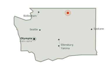
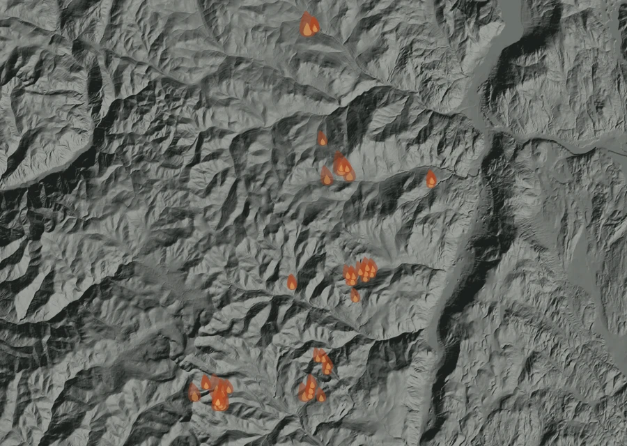
No cluster large enough to call a separate front. The heat is in one piece.
How it got here
Seven days of record on a day-82 fire
The record here begins at 3:13am on 22 Aug and runs to 2:25pm on 28 Aug — 155 hours, 712 readings of heat. The fire is on day 82, so the first 75 days are missing: nothing showed up from above until the fire was large enough and the sky over it clear enough for it to be seen.
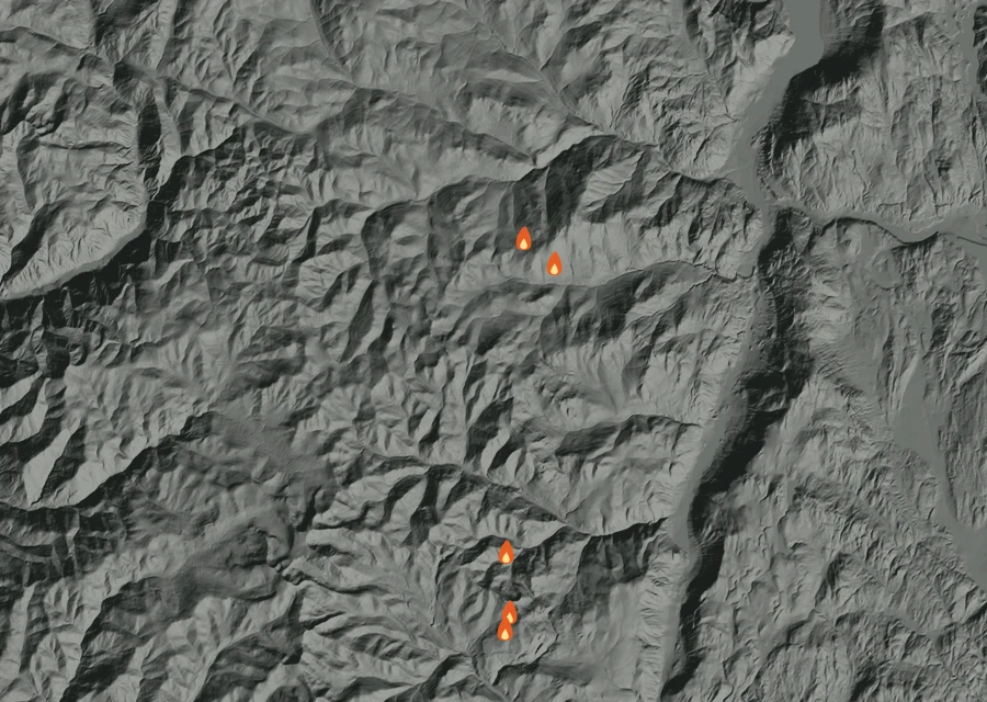
Day by day 7 days of record
-
Sat22 Aug
First readings
- 5 heat readings
- Heat from 3:13am to 3:13am
- Spread 8.1 miles from the recorded point at its furthest
- Burning through the pre-dawn
-
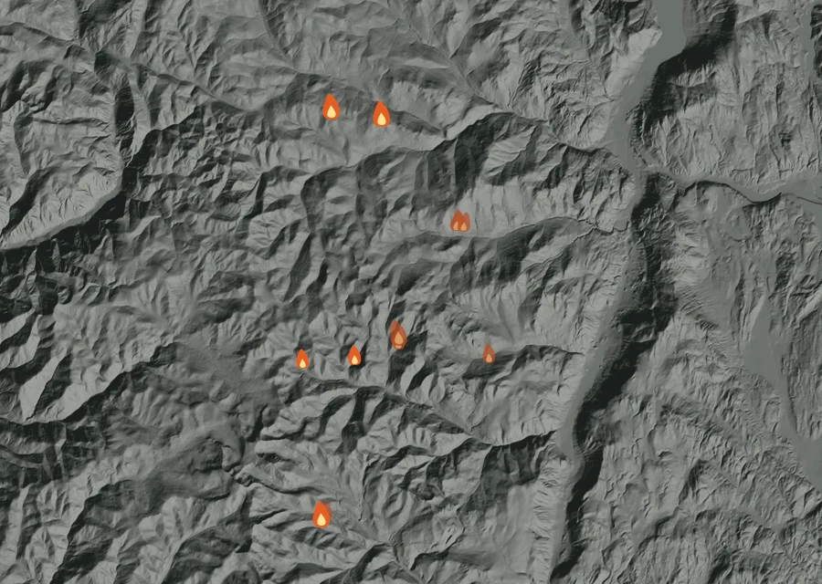
Sun23 Aug
Flaring up
- 14 heat readings
- Energy 6.8 times the day before
- Heat from 1:56am to 2:21pm
- Spread 12.5 miles from the recorded point at its furthest
- Burning through the pre-dawn and afternoon
-
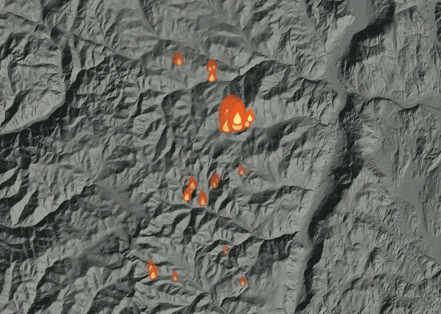
Mon24 Aug
Flaring up
- 44 heat readings
- Energy 39.2 times the day before
- Heat from 2:13am to 9:19pm
- Spread 12.6 miles from the recorded point at its furthest
- Burning through the pre-dawn, afternoon and night
-
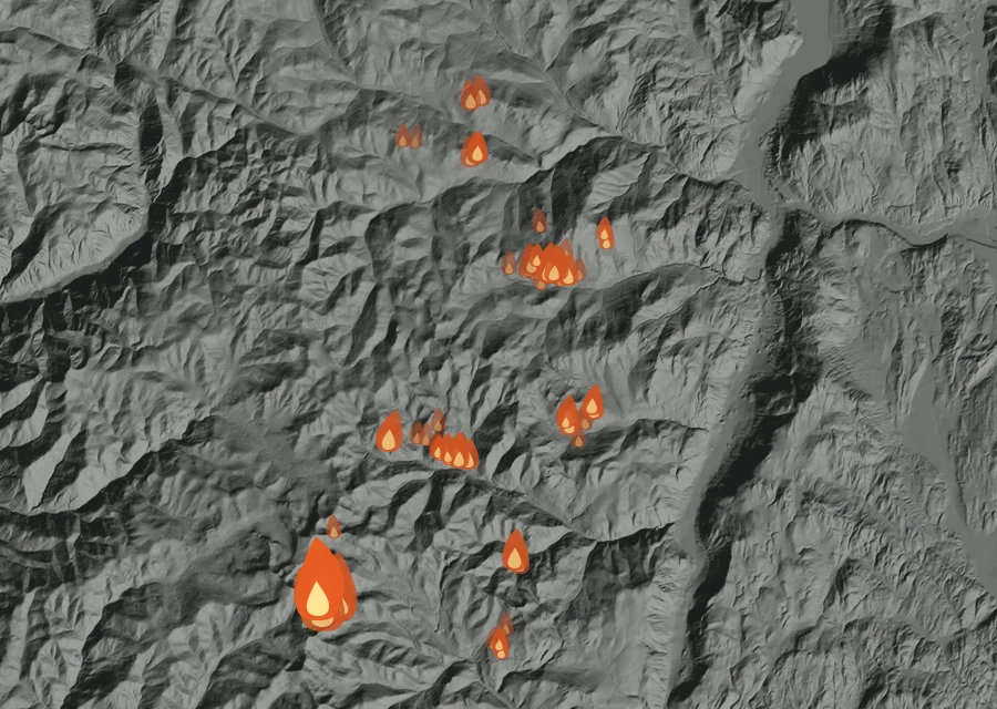
Tue25 Aug
Holding
- 106 heat readings
- Energy 29% down on the day before
- Heat from 1:56am to 8:21pm
- Spread 12.5 miles from the recorded point at its furthest
- Burning through the pre-dawn, afternoon and evening
-
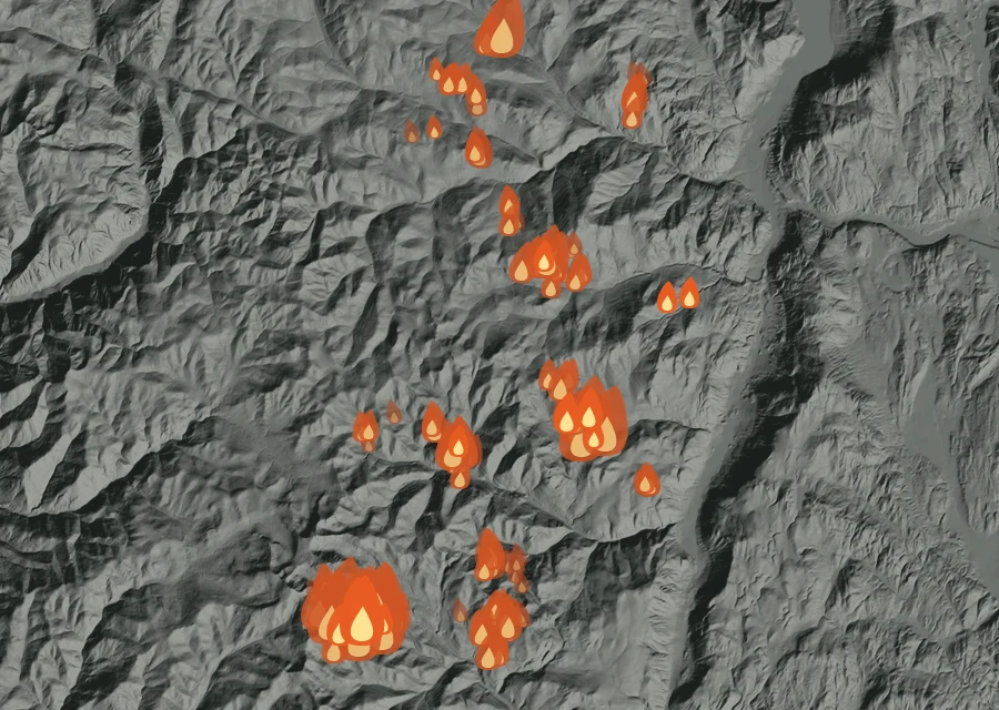
Wed26 Aug
The fiercest day
- 281 heat readings — the most of any day
- Energy 5.6 times the day before
- Heat from 1:56am to 9:00pm
- Spread 13.6 miles from the recorded point at its furthest
- Burning through the pre-dawn, morning, afternoon and night
-
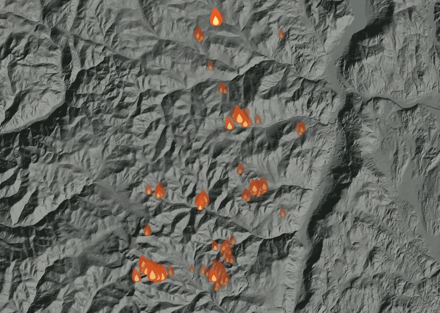
Thu27 Aug
Cooling off
- 198 heat readings
- Energy 89% down on the day before
- Heat from 2:22am to 9:38pm
- Spread 13.6 miles from the recorded point at its furthest
- Burning through the pre-dawn, morning, afternoon and night
-
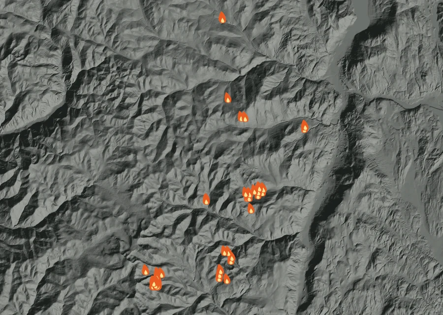
Fri28 Auglatest
Cooling off
- 64 heat readings
- Energy 63% down on the day before
- Heat from 2:05am to 2:25pm
- Spread 13.6 miles from the recorded point at its furthest
- Burning through the pre-dawn, morning and afternoon
How the record has moved
Each step is a change on the interagency incident record — acreage, containment or crews — with the date it was reported. No satellite reading is involved.
-
Sunday 26 July
First reported at 10 acres
10 ac -
Sunday 23 August
155,209 acres on record — 53% contained, 1563 personnel assigned
155,209 ac · 53% held · 1563 crew -
Monday 24 August
Grew to 155,227 acres — 1604 personnel
155,227 ac · 53% held · 1604 crew -
Tuesday 25 August
Grew to 155,491 acres — containment 56%, 1718 personnel
155,491 ac · 56% held · 1718 crew -
Wednesday 26 August
Grew to 156,699 acres — 1636 personnel
156,699 ac · 56% held · 1636 crew -
Thursday 27 August
Grew to 163,001 acres — containment 49%, 1595 personnel
163,001 ac · 49% held · 1595 crew -
Friday 28 August
Grew to 166,216 acres — 1570 personnel
166,216 ac · 49% held · 1570 crew -
Saturday 29 August
Grew to 166,868 acres — containment 41%, 1690 personnel
166,868 ac · 41% held · 1690 crew -
Sunday 30 August
Revised to 166,413 acres — containment 40%, 1684 personnel
166,413 ac · 40% held · 1684 crew -
Monday 31 August
Revised to 166,373 acres — containment 39%, 1312 personnel
166,373 ac · 39% held · 1312 crew -
Tuesday 1 September
Revised to 166,330 acres — containment 38%, 1352 personnel
166,330 ac · 38% held · 1352 crew -
Wednesday 2 September
Revised to 166,290 acres — 1326 personnel
166,290 ac · 38% held · 1326 crew -
Thursday 3 September
Revised to 166,151 acres — 1338 personnel
166,151 ac · 38% held · 1338 crew -
Friday 4 September
Revised to 166,106 acres — containment 44%, 1344 personnel
166,106 ac · 44% held · 1344 crew -
Saturday 5 September
Grew to 166,114 acres — containment 52%, 1242 personnel
166,114 ac · 52% held · 1242 crew -
Sunday 6 September
Grew to 166,116 acres — containment 59%, 1142 personnel
166,116 ac · 59% held · 1142 crew -
Monday 7 September
Revised to 166,084 acres — containment 67%, 1145 personnel
166,084 ac · 67% held · 1145 crew -
Wednesday 9 September
Revised to 166,018 acres — containment 76%, 895 personnel
166,018 ac · 76% held · 895 crew -
Thursday 10 September
Grew to 166,021 acres
166,021 ac · 76% held · 895 crew -
Saturday 12 September
Grew to 166,026 acres — 771 personnel
166,026 ac · 76% held · 771 crew -
Monday 14 September
Revised to 166,000 acres — containment 77%, 746 personnel
166,000 ac · 77% held · 746 crew -
Tuesday 15 September
Containment 81% — 727 personnel
166,000 ac · 81% held · 727 crew -
Wednesday 16 September
Grew to 166,012 acres — containment 84%, 616 personnel
166,012 ac · 84% held · 616 crew -
Saturday 19 September
Revised to 166,005 acres — containment 92%, 589 personnel
166,005 ac · 92% held · 589 crew -
Tuesday 22 September
Grew to 166,007 acres — 461 personnel
166,007 ac · 92% held · 461 crew -
Wednesday 23 September
Containment 93% — 439 personnel
166,007 ac · 93% held · 439 crew -
Wednesday 30 September
Containment 94% — 323 personnel
166,007 ac · 94% held · 323 crew -
Thursday 1 October
Containment 96% — 297 personnel
166,007 ac · 96% held · 297 crew -
Friday 2 October
Containment 98% — 265 personnel
166,007 ac · 98% held · 265 crew -
Saturday 3 October
Containment 99% — 247 personnel
166,007 ac · 99% held · 247 crew -
Thursday 15 October
Containment 100% — 122 personnel
166,007 ac · 100% held · 122 crew
100% of the perimeter is being reported as held. 122 people are assigned to it. It has grown from 10 acres when it was first written down to 166,007 now. Nothing has looked at it for 1153 hours, and the record still lists it as active.